Die hier aufgeführten Hema Maps Landkarten können über den Online-Shop der Firma Australien-Karten.de (Magellan Buchversand, Nesselstrasse 20, 46240 Bottrop, Deutschland, Tel. +49-2041-7657733, Fax +49-2041-7657732, Email: info@australien-karten.de) bestellt werden. Der Outback-Guide tritt dabei nur als Mittler auf (weiter Kontaktdetails siehe Impressum). Der eigentliche Vertrag wird mit der Firma Magellan Buchversand abgeschlossen, die dann auch den Versand und die Rechnungstellung veranlasst.
Hema Maps:
Australien Karte / Landkarte "Australia Handy Map"
Maßstab: 1 : 6,5 Mio
ISBN: 1875610006Übersichtskarte
Grobe Übersichtskarte über den gesamten Kontinent mit den wichtigsten Highways und einiger der bekanntesten Tracks.
Beschreibung vom Verlag: "A complete, easy to read map of Australia showing all borders, capital cities, major towns, highways and connecting routes. Distances between all major destination points are provided. The map features a distinctive Aboriginal design border, which makes it an attractive map."
Hema Maps:
Australien Karte / Landkarte "Australia Large"
Maßstab: 1 : 6,5 Mio
ISBN: 1875610006Übersichtskarte
Grobe Übersichtskarte über den gesamten Kontinent mit den wichtigsten Highways.
Hema Maps:
Australien Karte / Landkarte "Australia Terrain & Road"
Maßstab: 1 : 4,5 Mio
ISBN: 1865000272Übersichtskarte
Grobe Übersichtskarte über den gesamten Kontinent mit den wichtigsten Highways und einiger der bekanntesten Tracks.
Hema Maps:
Australien Karte / Landkarte "Australia Outback Adventure Map"
Maßstab: 1 : 5 Mio
ISBN: 1865000272Übersichtskarte
Grobe Übersichtskarte über das gesamte Outback (also fast den gesamten Kontinent)
Beschreibung vom Verlag: "Planning your trip to experience Australia's Outback in 2002 has been made easy with the launch of Australia's Outback Map featuring spectacular outback images and complete listing of events and activities for 2002 Australia's Year of the Outback. The map includes full terrain detail, a comprehensive road map and is bordered by 46 images representing a cross section of all Australia's Outback. The reverse side lists a month-by-month guide and contact details for all the events and activities, from cattle droves to car treks and river regattas and bush races, officially registered on the calendar to celebrate 2002 as Australia's year of the Outback."
Camps Australia Wide:
Campingführer Australien - Camps Australia Wide 7
400 Seiten
ISBN: 0980570379Campingführer
Hema Maps:
Straßenatlas Australien "Australia Handy Atlas B5" (Ringbindung)
152 Seiten
ISBN: 1865006394Straßen-Atlas
Kompakter Straßenatlas zu ganz Australien.
Beschreibung vom Verlag: "Hema Maps produces the largest range of Road Atlases in Australia in 3 different sizes and 7 different formats. All Atlases feature the most comprehensive road detail available that is field checked, on the ground, using GPS mapping system by Hema Maps. They all feature roadside rest areas, camping areas, outback roadhouses as well as a comprehensive road-distancing network. In addition each of these atlases has a slightly different focus, the Road Atlas has National Park info and 4X4 maps, the Touring Atlas features road rules and driving tips while the handy Atlas is in a very compact glove box size. All of these atlases come in a choice of conventionally bound or spiral bound formats. So no matter what your needs are for a road Atlas, Hema Maps Road Atlas series really will get you there. They are available wherever maps are sold."
Hema Maps:
Australia Motorcycle Atlas B5 (Ringbindung)
152 Seiten
ISBN: 1865006157Straßen-Atlas
Straßenatlas speziell für Motorradfahrer. Unterscheidet sich aber nur wenig vom normalen Straßenatlas.
Beschreibung vom Verlag: "We have a Australia Motorbike Atlas and it has been extremely successful and we have now taken a furthur step to evolve this product to better cater for motorcyclists' needs and this new product is called the Australia Motorcycle Atlas. We have worked with one of Australia's leading mototcycle writers, Peter (The Bear) Thoeming to deatil 50 Top Rides throughout Australia and each of these rides has a full page devoted to it at the start of the book. Each ride is described with respect to what to see and all the features and each ride is referenced back to the totally revised Road Atlas, which takes up the rear 92 pages of the book."
Hema Maps:
Touring-Atlas Australien "Australia Touring Atlas A4" (Ringbindung)
152 Seiten
ISBN: 1865006386Straßen-Atlas (Ringbuch Version)
Straßenatlas zu ganz Australien.
Beschreibung vom Verlag: "The Australia Touring Atlas (A4) contains 112 pages of state, regional, suburban and city maps ... a complete selection of the essential maps needed to tour Australia. An important feature of this atlas is its special 'Touring Tips and Safety Section' which outlines the common road rules across Australia, tips on travelling with children, emergency first aid, what to do after a breakdown, and much more. A full National Parks amenities matrix and quick find distance charts are included."
Hema Maps:
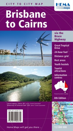
Brisbane to Cairns
Maßstab: 1 : 2 Mio
ISBN: 1875992375Detailkarte / Regionalkarte
Hema Maps:
Cairns to Broome on the Savannah Way
Maßstab: 1:2,2 Mio
ISBN: 1865002666Detailkarte / Regionalkarte
Hema Maps:
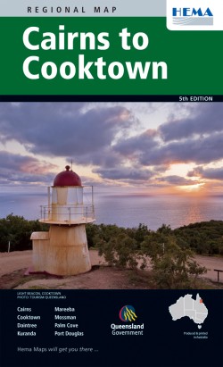
Cairns to Cooktown
Maßstab: 1:250.000
ISBN: 1865002267Detailkarte / Regionalkarte
Hema Maps:
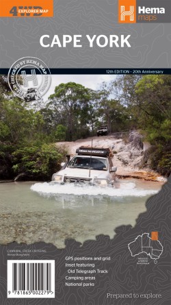
Cape York
Maßstab: 1:1Mio
ISBN: 1865002275Detailkarte / Regionalkarte
Recht detaillierte Überscihtskarte; Auf der Rückseite Infos zu Sehenswürdigkeiten und Eigenheiten der Region.
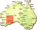
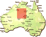
Hema Maps:
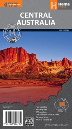
Central Australia
Maßstab: 1:2 Mio
ISBN: 1865006734Detailkarte / Regionalkarte
Sehr detaillierte Übersichtskarte auf der selben Kartenbasis wie die Great Desert Tracks (allerdings ohne GPD-Punkte)
Fazit: Sehr empfehlenswertes Kartenmaterial
Hema Maps:
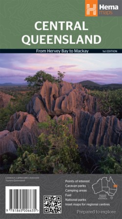
Central Queensland
Maßstab: 1:1 Mio
ISBN: 1865006637Detailkarte / Regionalkarte
Hema Maps:
East Gippsland & the Sapphire Coast
Maßstab: 1:300.000
ISBN: 1865002208Detailkarte / Regionalkarte
Beschreibung vom Verlag: "This extremely detailed map follows in the footsteps of its predecessors in the range. With a huge amount of detail in the road and track patterns, it also features international symbols showing facilities, detailed kilometre readings and it doesn't stop at the Victorian border, giving equal detail to the country around Eden and all that far southern area of NSW. The Map is punctuated with the locations of tourist information centres and on the back of the map these centres are listed with contact details."
Hema Maps:
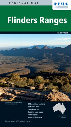
Flinders Ranges
Maßstab: 1:400.000
ISBN: 1865004030Detailkarte / Regionalkarte
Hema Maps:
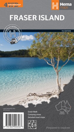
Fraser Island
Maßstab: 1:130.000
ISBN: 1865006564Detailkarte / Regionalkarte
Hema Maps:
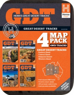
Outback Landkarten-Paket
"Great Desert Tracks Map Pack"
4 Landkarten
ISBN: 1865006289Detaillierte Outback-Karten
(Sammlung der folgenden 4 Great-Desert Track Karten)
(detaillierte Besprechung)Derzeit das beste und aktuellste Material zum Outback, inkl. zahlreichen GPS-Punkten. HEMA scheut für diese Karte keine Kosten und Mühen und lässt jedes Jahr 4WDs Expeditionen das Outback durchqueren um detaillierte und aktuelle GPS Daten für die aufgeführten Tracks zu erfassen.
Fazit: Absolut empfehlenswert!
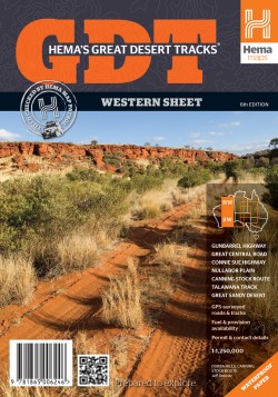
Hema Maps:
Great Desert Tracks - Blatt West
Maßstab: 1:1.25 Mio
ISBN: 1865006246Detaillierte Outback-Karte
(detaillierte Besprechung)Derzeit das beste und aktuellste Material zum Outback, inkl. zahlreichen GPS-Punkten. HEMA scheut für diese Karte keine Kosten und Mühen und lässt jedes Jahr 4WDs Expeditionen das Outback durchqueren um detaillierte und aktuelle GPS Daten für die aufgeführten Tracks zu erfassen.
Fazit: Absolut empfehlenswert!
Hema Maps:
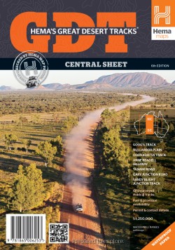
Great Desert Tracks - Blatt Central
Maßstab: 1:1.25 Mio
ISBN: 1865006254Detaillierte Outback-Karte
(detaillierte Besprechung)Derzeit das beste und aktuellste Material zum Outback, inkl. zahlreichen GPS-Punkten. HEMA scheut für diese Karte keine Kosten und Mühen und lässt jedes Jahr 4WDs Expeditionen das Outback durchqueren um detaillierte und aktuelle GPS Daten für die aufgeführten Tracks zu erfassen.
Fazit: Absolut empfehlenswert!
Hema Maps:
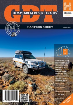
Great Desert Tracks - Blatt East
Maßstab: 1:1.25 Mio
ISBN: 1865006262Detaillierte Outback-Karte
(detaillierte Besprechung)Derzeit das beste und aktuellste Material zum Outback, inkl. zahlreichen GPS-Punkten. HEMA scheut für diese Karte keine Kosten und Mühen und lässt jedes Jahr 4WDs Expeditionen das Outback durchqueren um detaillierte und aktuelle GPS Daten für die aufgeführten Tracks zu erfassen.
Fazit: Absolut empfehlenswert!
Hema Maps:
Great Desert Tracks - Simpson Desert
Maßstab: 1:500.000
ISBN: 1865006270Detaillierte Outback-Karte
(detaillierte Besprechung)Derzeit das beste und aktuellste Material zum Outback, inkl. zahlreichen GPS-Punkten. HEMA scheut für diese Karte keine Kosten und Mühen und lässt jedes Jahr 4WDs Expeditionen das Outback durchqueren um detaillierte und aktuelle GPS Daten für die aufgeführten Tracks zu erfassen.
Fazit: Absolut empfehlenswert!
Hema Maps:
Detaillierte Outback-Karten (Set)
4WD Explorer Map Pack
12 Outback-Landkarten
ISBN: 1865000795Enthaltene Karten: Australia's Outback Adventures, Cape York, Central Australia, Flinders Ranges, Fraser Island, High Country, Kimberley, Outback NSW, Pilbara, Queensland's Outback, Red Centre, Top End & Gulf.
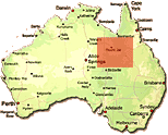
Hema Maps:
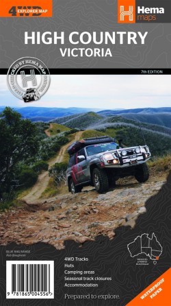
High Country Victoria
Maßstab: 1:200.000
ISBN: 1865004553Detailkarte / Regionalkarte
Hema Maps:
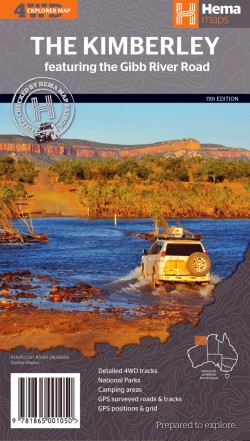
The Kimberley
Maßstab: 1:1 Mio
ISBN: 1865001058Detailkarte / Regionalkarte
Hema Maps:
Mackay and Whitsundays
Maßstab: 1:250.000
ISBN: 1865002615Detailkarte / Regionalkarte
Hema Maps:
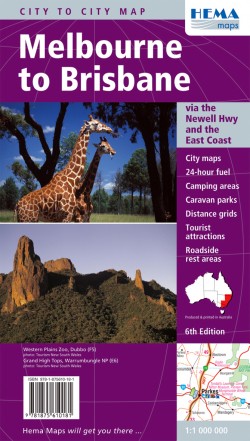
Melbourne to Brisbane
Maßstab: 1:1 Mio
ISBN: 1875610189Detailkarte / Regionalkarte
Hema Maps:
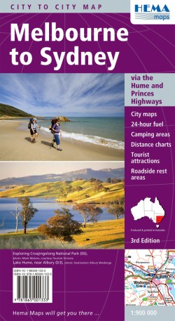
Melbourne to Sydney
Maßstab: 1:900.000
ISBN: 1865001333Detailkarte / Regionalkarte
Hema Maps:
North East New South Wales
Maßstab: 1:375.000
ISBN: 1875992499Detailkarte / Regionalkarte
Hema Maps:
North Queensland
Maßstab: 1:1.75 Mio
ISBN: 1865001570Detailkarte / Regionalkarte
Hema Maps:
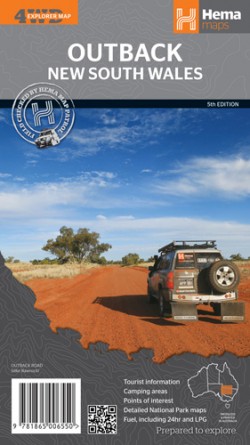
Outback New South Wales
Maßstab: 1:1 Mio
ISBN: 1865006556Detailkarte / Regionalkarte
Detaillierte Übersichtskarte über die Region
Hema Maps:
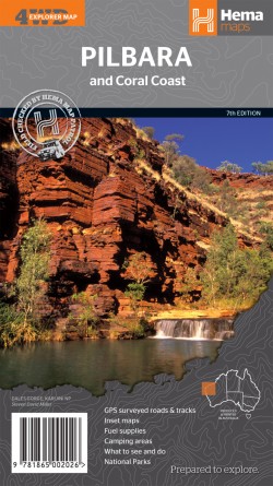
Pilbara and Coral Coast
Maßstab: 1:1.25 Mio
ISBN: 186500202XDetailkarte / Regionalkarte
Hema Maps:
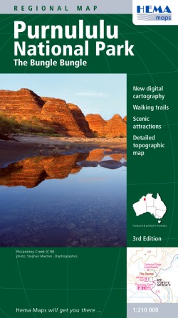
Purnululu National Park: The Bungle Bungle
Maßstab: 1:210.000
ISBN: 186500491XDetailkarte / Regionalkarte
Beschreibung vom Verlag: "The Map gives a good indication as to the comprehensive way in which this project has been approached, with an excellent regional road map, showing roads, tracks, distances and facilities from Halls Creek to Wyndham. On the other side is a complete travel guide to the entire area, giving detailed information on particular features, all relevant contact numbers and some spectacular images, to wet the viewers appetite for what they are about to see. "
Hema Maps:
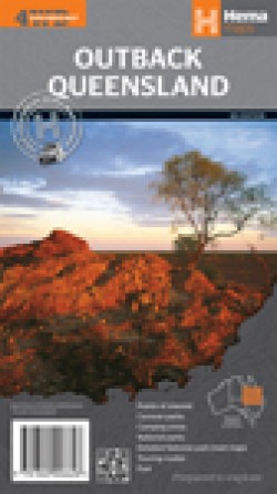
Outback Queensland
Maßstab: 1:2 Mio
ISBN: 1865006629Detailkarte / Regionalkarte
Hema Maps:
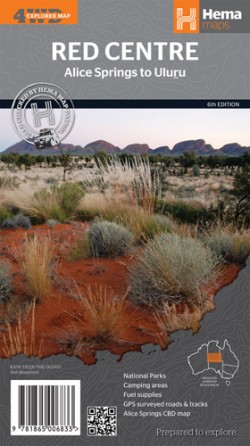
Red Centre
Maßstab: 1:750.000
ISBN: 1865006833Detailkarte / Regionalkarte
Hema Maps:
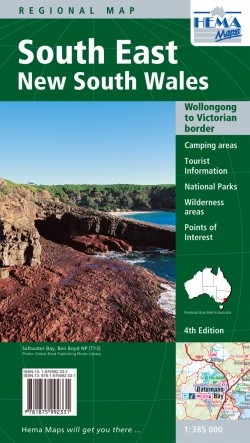
South East New South Wales
Maßstab: 1:385.000
ISBN: 1875992332Detailkarte / Regionalkarte
Hema Maps:
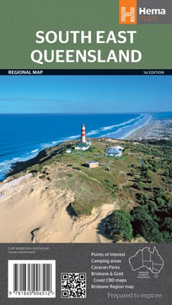
South East Queensland
Maßstab: 1:500.000
ISBN: 1865006513Detailkarte / Regionalkarte
Hema Maps:
South West Western Australia
Maßstab: 1:750.000
ISBN: 1865001392Detailkarte / Regionalkarte
Recht detaillierte Überscihtskarte; Auf der Rückseite Infos zu Sehenswürdigkeiten und Eigenheiten der Region.
Hema Maps:
South West Western Australia
Maßstab: 1:750.000
ISBN: 1865001392Detailkarte / Regionalkarte
Hema Maps:
Sydney to Brisbane
Maßstab: 1:1 Mio
ISBN: 1865001538Detailkarte / Regionalkarte
Hema Maps:
Top End and Gulf
Maßstab: 1:1.65 Mio
ISBN: 1875992618Detailkarte / Regionalkarte
Recht detaillierte Überscihtskarte; Auf der Rückseite Infos zu Sehenswürdigkeiten und Eigenheiten der Region.
Hema Maps:
Tropical North Queensland
Maßstab: 1:600.000
ISBN: 1865003395Detailkarte / Regionalkarte
Hema Maps:
Landkarte/Straßenkarte New South Wales
Maßstab: 1:1.4 Mio
ISBN: 186500670XKarte zum Bundesstaat
Mehr Landkarten von New South Wales
Hema Maps:
Landkarte/Straßenkarte Northern Territory
Maßstab: 1:1.75 Mio
ISBN: 1865006726Karte zum Bundesstaat
Mehr Landkarten aus dem Northern Territory
Hema Maps:
Landkarte/Straßenkarte Queensland
Maßstab: 1:2.5 Mio
ISBN: 1865005649Karte zum Bundesstaat
Mehr Landkarten von Queensland
Hema Maps:
Landkarte/Straßenkarte South Australia
Maßstab: 1:1.75 Mio
ISBN: 186500667XKarte zum Bundesstaat
Mehr Landkarten von South Australia
Hema Maps:
Landkarte/Straßenkarte Tasmanien
Maßstab: 1:480.000
ISBN: 1865006548Karte zum Bundesstaat
Mehr Landkarten von Tasmanien
Hema Maps:
Landkarte/Straßenkarte Victoria
Maßstab: 1:850.000
ISBN: 1865005630Karte zum Bundesstaat
Mehr Landkarten von Victoria
Hema Maps:
Western Australia Handy
Maßstab: 1:2.5 Mio
ISBN: 1865005665Karte zum Bundesstaat
Mehr Landkarten von Western Australia
Hema Maps:
Adelaide & Region Handy
Maßstab: 1:270.000
ISBN: 1875992650Stadtplan
Hema Maps:
Brisbane & Region Handy
Maßstab: 1:100.000
ISBN: 1865006297Stadtplan
Hema Maps:
Cairns & Region
Maßstab: 1:22.500
ISBN: 1865002038Stadtplan
Hema Maps:
Canberra & Region Handy
Maßstab: 1:60.000
ISBN: 1865002240Stadtplan
Hema Maps:
Darwin & Region Handy
Maßstab: 1:25.000
ISBN: 1865006335Stadtplan
Hema Maps:
Gold Coast & Region Handy
Maßstab: 1:100.000
ISBN: 1865006319Stadtplan
Hema Maps:
Melbourne & Region Handy
Maßstab: 1:115.000
ISBN: 1855006650Stadtplan
Hema Maps:
Perth & Region Handy
Maßstab: 1:80.000
ISBN: 1855006324Stadtplan
Hema Maps:
Sydney & Region Handy
Maßstab: 1:100.000
ISBN: 1865006300Stadtplan
Hema Maps:
Townsville & Region
Maßstab: 1:22.500
ISBN: 1855001411Grober Stadtplan & Umgebung
Hema Maps:
Hervey Bay and Maryborough
Maßstab: 1:22.500
ISBN: 1875992529Stadtplan
Beschreibung vom Verlag: "This double-sided map contains two detailed street maps of these popular tourist destinations. Both maps have all streets and roads fully-indexed and have a general information index on places of interest, schools, parks, hospitals and emergency services."
Hema Maps:
Rockhampton and Capricorn Coast
Maßstab: 1:25.000
ISBN: 1855001780Stadtplan
Beschreibung vom Verlag: "This map has been completely revised, expanded and updated to include Rockhampton and the Capricorn Coast. The map is now double sided and includes inset maps of Yeppoon, Emu Park, Kepple Sands, and Gracemere."
Hema Maps:
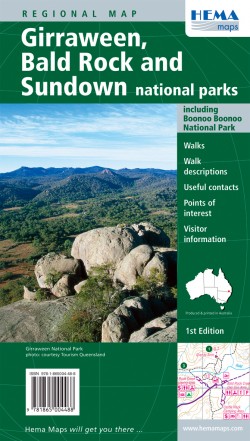
Girraween, Bald Rock & Sundown Nationalpark
Maßstab: 1:37.000
ISBN: 1865004480Nationalpark Detailkarte
Beschreibung vom Verlag: "A comprehensive map covering the popular granite landscapes of Girraween, Bald Rock and Boonoo Boonoo National Parks. All tracks and roads in the region are shown, along with ranger stations, walking tracks, swimming holes, camping areas, and contour information. Detailed descriptions are given on each of the major walks in the parks."
Hema Maps:
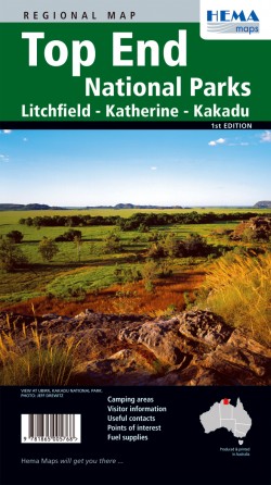
Litchfield-, Katherine-, & Kakadu Nationalpark - Top End Nationalparks
Maßstab: 1:350.000
ISBN: 1865005762Nationalpark Detailkarte
Hema Maps:
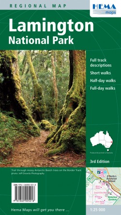
Lamington Nationalpark
Maßstab: 1:25.000
ISBN: 1865005215Nationalpark Detailkarte
Beschreibung vom Verlag: "This map covers the whole area of the park and all the graded walking tracks that start from Binna Burra and O'Reilly's. It has been drawn at a good walking scale of 1:35 000 and shows all points of interest in the park. The walking tracks are shown in different colours on the map and have been broken up into short walks, half day walks and full day walks. A detailed description of each of the walks is shown on the back of the map."
Hema Maps:
Maßstab: 1:210.000
ISBN: 186500491XNationalpark Detailkarte
Beschreibung vom Verlag: "The Map gives a good indication as to the comprehensive way in which this project has been approached, with an excellent regional road map, showing roads, tracks, distances and facilities from Halls Creek to Wyndham. On the other side is a complete travel guide to the entire area, giving detailed information on particular features, all relevant contact numbers and some spectacular images, to wet the viewers appetite for what they are about to see. "
Camps Australia Wide:
400 Seiten
ISBN: 0980570379Campingführer, der Australien komplett abdeckt
Camps Australia Wide:
Campingführer Australien - Caravan Parks Australia Wide
328 Seiten
ISBN: 0975001795Campingführer, der Australien komplett abdeckt
Hema Maps:
Campingführer New South Wales (Ostküste Australien)
128 Seiten
ISBN: 1865005223Campingführer zum Bundesstaat
Woodslane/Boiling Billy:
Campingführer Northern Territory (Norden Australiens)
213 Seiten
ISBN: 1921203978Campingführer zum Bundesstaat
Woodslane/Boiling Billy:
Campingführer Queensland (Ostküste Australien)
429 Seiten
ISBN: 1921606150Campingführer zum Bundesstaat
Woodslane/Boiling Billy:
Campingführer Victoria (Ostküste Australien)
349 Seiten
ISBN: 1921203676Campingführer zum Bundesstaat
Woodslane/Boiling Billy:
Campingführer Western Australia (Westküste Australien)
309 Seiten
ISBN: 1921606169Campingführer zum Bundesstaat
Hema Maps:
Upside Down World in Envelope
Maßstab: 1:40 Mio.
ISBN: 1965001084Weltkarte